 Click on any of the following maps
(or links to maps) of railroads in New Hampshire:
Click on any of the following maps
(or links to maps) of railroads in New Hampshire:New Hampshire Railroad Maps
Updated: 2/1/25
These pages feature different New Hampshire railroad maps from a variety of sources. I hope to add to these as additional maps come my way. Anyone knowing of other useful maps from the public domain that might be scanned and included on these pages should contact me by e-mail.
Click on any of the following maps
(or links to maps) of railroads in New Hampshire:
 Three Library of
Congress collection maps of railroads in the White Mountains of NH:
1
2 3
Three Library of
Congress collection maps of railroads in the White Mountains of NH:
1
2 3
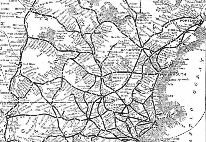
![]() Map of the Boston & Maine System in New Hampshire (and nearby areas) from a 1933 Boston & Maine Timetable.
Map of the Boston & Maine System in New Hampshire (and nearby areas) from a 1933 Boston & Maine Timetable.
![]() Maps of the
Boston & Maine System in New Hampshire north
/ south (and nearby areas) from a 1915 Boston & Maine Timetable.
Maps of the
Boston & Maine System in New Hampshire north
/ south (and nearby areas) from a 1915 Boston & Maine Timetable.
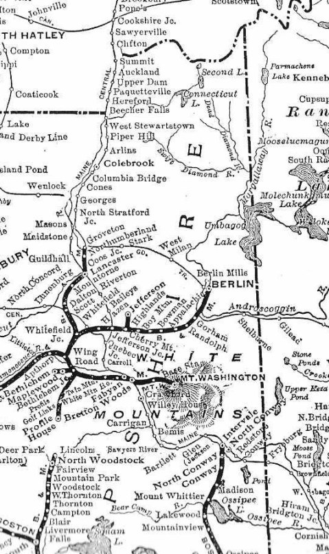
![]() Map of Railroad
Lines in the White Mountains
Map of Railroad
Lines in the White Mountains
![]() Map of New Hampshire's Railroad Systems, devised by Christopher Marshall.
Map of New Hampshire's Railroad Systems, devised by Christopher Marshall.
![]() Link to map of
Current
Pan Am Rail System in New Hampshire, from Pan Am Railways homepage.
Link to map of
Current
Pan Am Rail System in New Hampshire, from Pan Am Railways homepage.
![]() Link to archive of Historic USGS Maps of New Hampshire, from Dimond Library of the University of New Hampshire and owing to the efforts of Christopher Marshall; detailed topographical maps from various periods in New Hampshire's history, with rail lines clearly marked.
Link to archive of Historic USGS Maps of New Hampshire, from Dimond Library of the University of New Hampshire and owing to the efforts of Christopher Marshall; detailed topographical maps from various periods in New Hampshire's history, with rail lines clearly marked.